

Saturday, February 25, 2017, it goes: as I explained in my previous post, I set myself as challenge 2017 to, little by little, a crossing (partial…) of the Switzerland between Zurich and Geneva, more precisely by following the ridges of the Jura, between Dielsdorf and Nyon. So, in this Saturday of February to the idyllic weather forecast, go for the first step:
Defined as “easy” to the level of requirements (because borrowing easy trails and paths), but “difficult” at the physical level (for long), it is with some trepidation that I launch: because 25 km distance and 900 m denivelation positive (“D +”), it is perhaps a little long to start the year and validate that shoes and equipment are good. But this step has the advantage to have a multitude of “plan B”, if we can’t to the side.
The program of the day, it’s so “Dielsdorf – Brugg”. To have a way to rapid retreat if this step doesn’t go as planned, I decide to drive the route since my native French-speaking Switzerland. 2 hours drive from my GPS, it was count without traffic jams and a fog to cut with a knife. Coming so late on my schedule in Baden, a small town located at the 2/3 of the course of the day. The “GartenStrasse” car park is ideally located and not too expensive to leave my vehicle the day. I then joined Dielsdorf by bus and train, with magical assistance from the SBB app telling me where to go and which allows me to buy my ticket in 3 clicks. I love him.
So here I am advantage at 10.45, 3 h 15 from Lausanne. 30-minute delay on the schedule, due to the traffic jams on the highway. To a stage of an announced duration of 7 h 20, with the sun setting still pretty early this time of year, is a bit limit.
Especially since I know not at all how can I position myself compared to the announced official duration…
So I take the road without any certainty to reach the goal. The course begins with the crossing of Dielsdorf, a very very quiet village at the freshly renovated buildings. I begin a climb of about 1 h 30 through all neat manicured gardens, then of vineyards and forests.
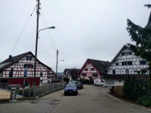
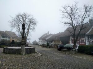 All this under a wet mist and shuttered. The first crossed village is Regensberg, a village in height, which, without the mist, must dominate the Plains. Village, and, in view of the car park, inhabited by rich Zurich. It almost looks upset when we cross the streets.
The climb, sometimes rough, but most of the time soft, continues through forest paths, through freshly manicured trees. I lack, at 10 metres, a collision with a deer running through the mist, who had forgotten his fog. I don’t know which of the two will have had the most fear. But she ran faster than me.
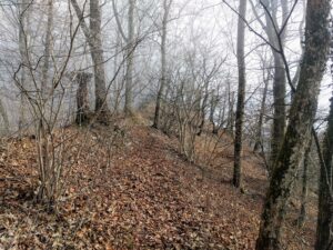
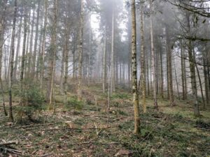 After a while under the fog, it’s in the mist the route continues. And that’s where I’m sorry to have forgotten the bonnet. I who felt guilty about forgetting a Cap…
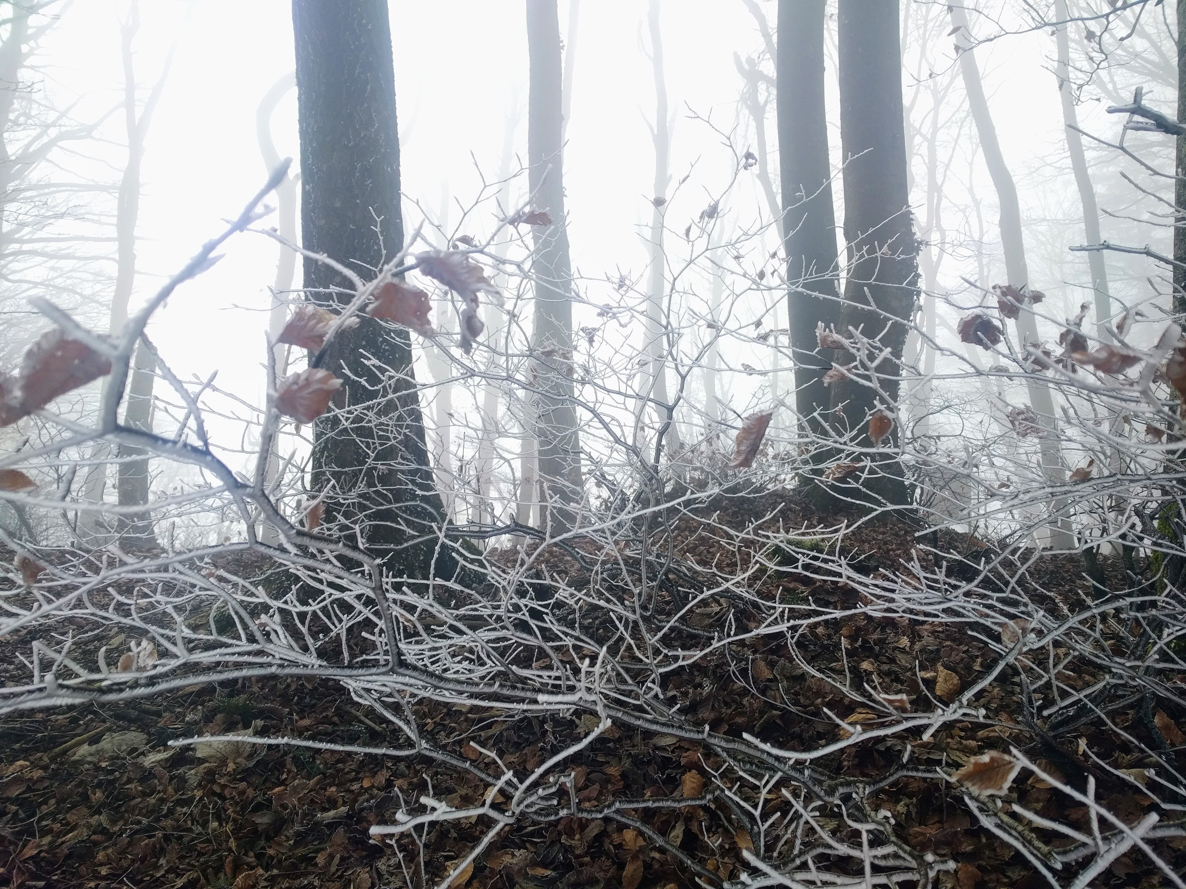
Because in the mist, it’s cold. Which gives the landscape a magical beauty, but prevents me from stopping for breaks, for fear of turning into ice.
The evidence:
It’s arriving at the Summit that finally I can see the blue sky, above a SkyGuide radar. I reached the highest point of the route: 856 m. But the viewpoint which is there isn’t bad today: it is not the plain.


 After this panorama, it is indeed to more blue sky that I head. Temperature and humidity become more enjoyable, and forest roads are replaced by trails, first on a bed of leaves, and then in the rock, flat. An irregular rock and bent over, quite difficult to walk. It is at this time, I feel the pains in the feet, and I regret not having placed preventively “compeed” on my heels.
It must be said that historically, I am a regular of the blisters (or bulbs) feet, especially on the heels. So far nothing helps: any pair of shoes don’t spare me. I realize that this will be the biggest challenge of my challenge 2017.
A small pause picnic later to a place where the view is unobstructed on the plain and its industries, I’m back on road after having tightened my shoes to start the descent towards Baden, intermediate city of the route. A descent on little sloping forest roads, but in the shade and blind. It is not the nicest part of the route of the day.
Little by little, we reach civilization, with views of all industries (ABB on dozens of hectares…), then a nice release on Baden. On the descent, it bypasses a beautiful fortress on a hillside, then it is by stairs that you joined the city.
In fact, that day, it’s Carnival in Baden. So I’m going through the main street to the sounds of a Guggen music contest, in the middle of throwing confetti and children disguised.
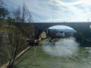
Baden, the signposted route made a detour, first by following the Limmat, then across the city. I advise you to respect this detour that makes you go through beautiful places, via an outdoor elevator design providing you a few metres of ascent.
 Across the city, I’m not attentive enough to the markup: I get lost, and, when I find the signs of tourism, I put a few kilometers to realize that I’m on the right path. Fortunately not completely opposite of my destination, it’ll take even 30 minutes to join the good trace…
I’m starting the second climb of the day, much shorter than the first, to Baldegg and its water tower. My feet suffer, my legs hurt. There’s still 10 km to do.
After the climb, a long moment of false flat on forest tracks without charm, allow me to join the Gebenstorfer Horn, view popular in the region, on the “water tower of the Switzerland”, region or the Aare and the Limmat come together, or split, I don’t know too much:
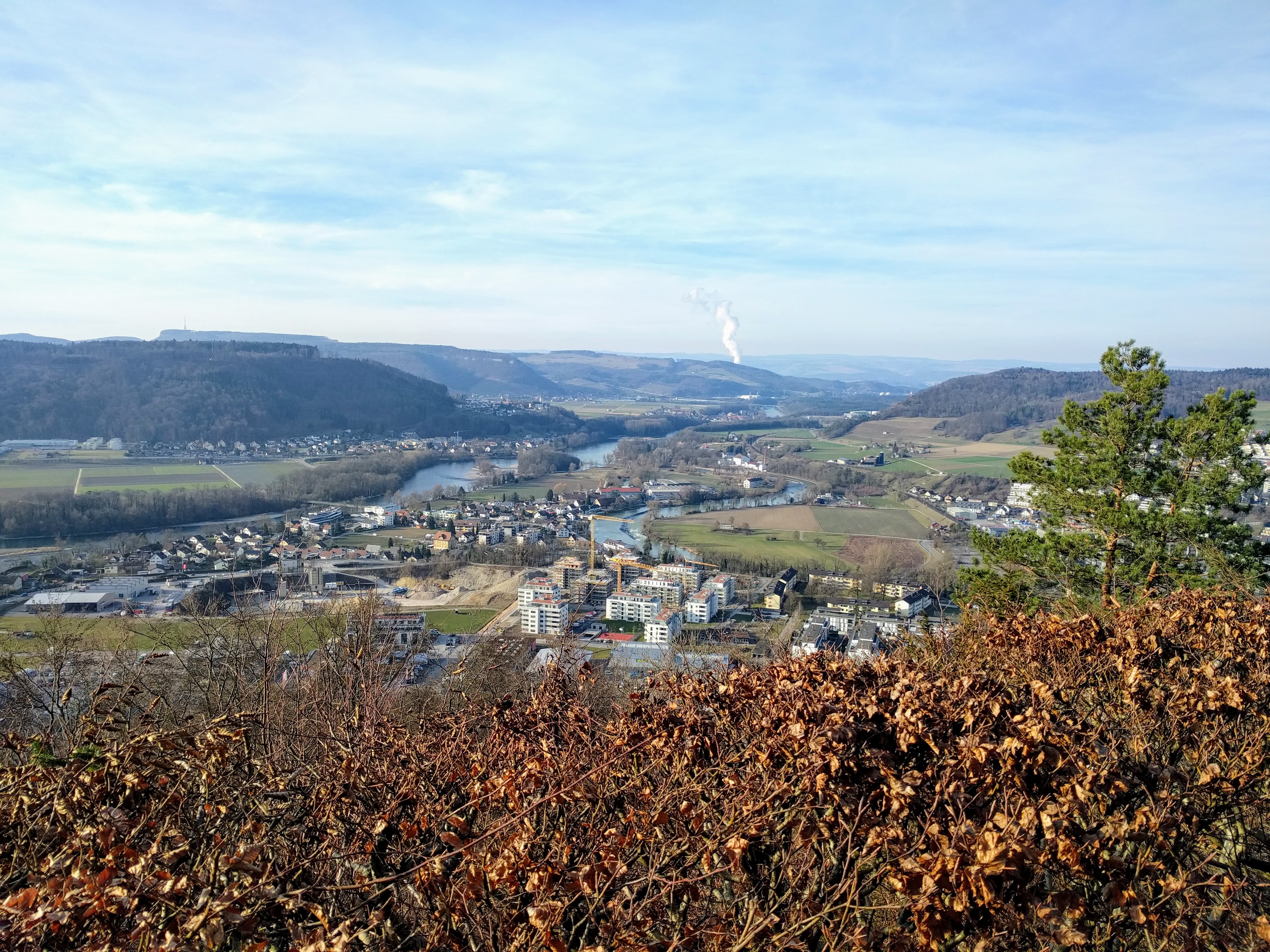
I must say that my state of fatigue and my feet into mush slightly prevented me to appreciate the beauty of the panorama. More urban “hubbub” that rises from the plain somewhat spoils the view. Even if it’s Saturday. Maybe it’s worse the week…
White smoke in the distance, is the vapour of the Beznau Leibstadt nuclear power plant. I think.
After a good break to recharge my batteries, I began the final descent on the plain: 30 minutes on forest tracks, to the sound of techno music in a carnival procession which rises from the plain. I am happy because I now know that I get at the end of this first step, as I suffer from my legs to my ankles, my feet.
It is an approach of zombie that I agree with the plain. I have 1 hour trudge to join Brugg station, crossing Gebenstorf, a residential village with no charm, and along the Reuss and the Aare. I hesitate to take the bus to get to the station, but I hold on, hanging me up to the idea of a cold beer to my arrival at the station.
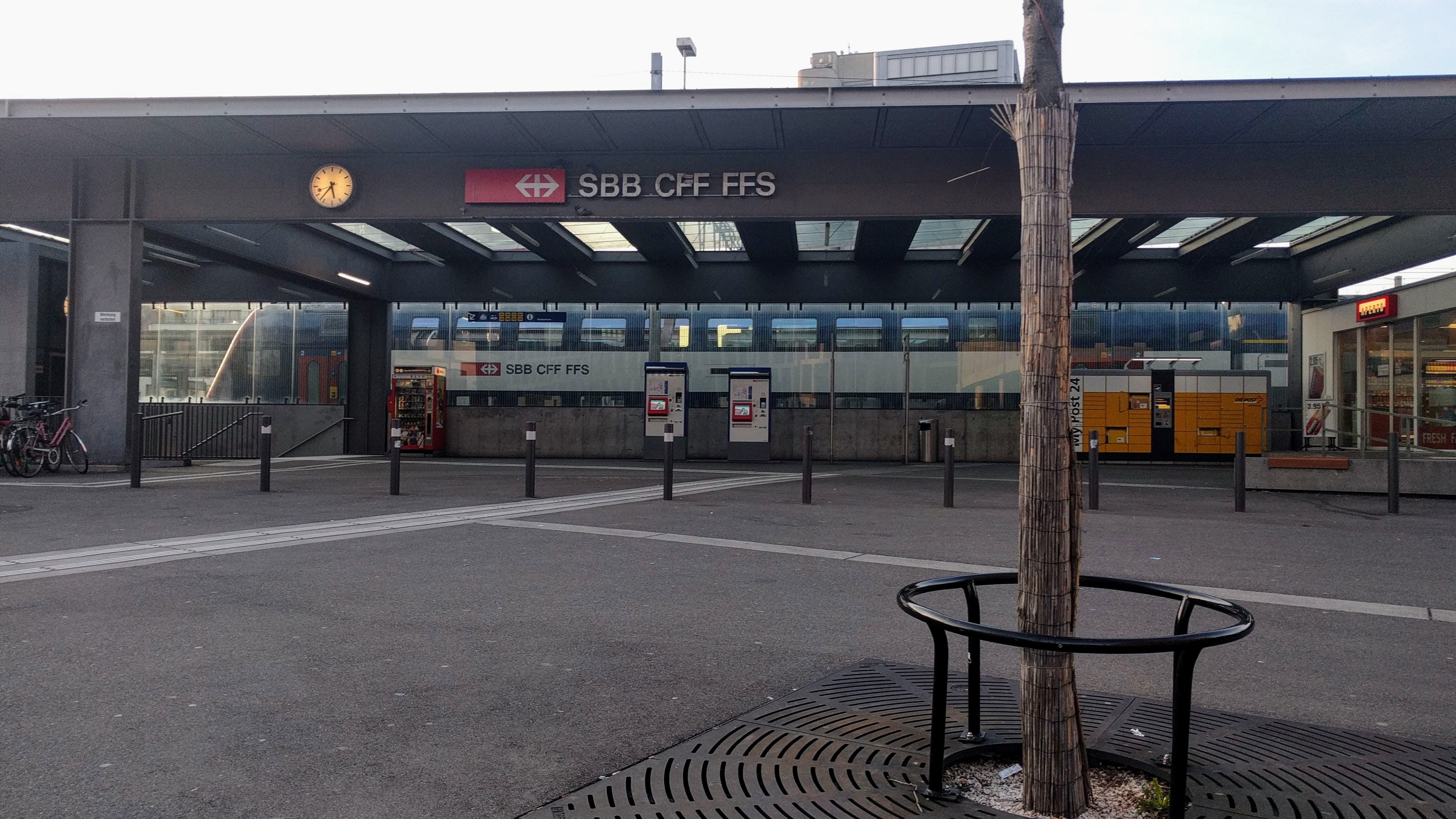 And that’s the drama: no view at Brugg station Bistro. So I arrived, happy and euphoric to have passed my physical limits, but I won’t right to my symbolic reward.
In the end, I did the course in a little less than 7 hours, including my breaks. I hold so the durations mentioned by Switzerland Rando (7:20) are wide enough. Side personally, I realize that in addition to the normal muscle pain in view of my training, it’s with my feet and their blisters I have to fight through my 2017 challenge: it’s not a pretty sight.
But the satisfaction of coming to the end erase the pain! And the absence of beer, too.
I take the train, direct and frequent to Baden. I found my car, the circle is complete!
That is the record of this first step. The second is not scheduled, insofar as the weather in the short term is not good, and… should I treat my feet. And I work a little bit, too.
Follow!
Be the first to comment